
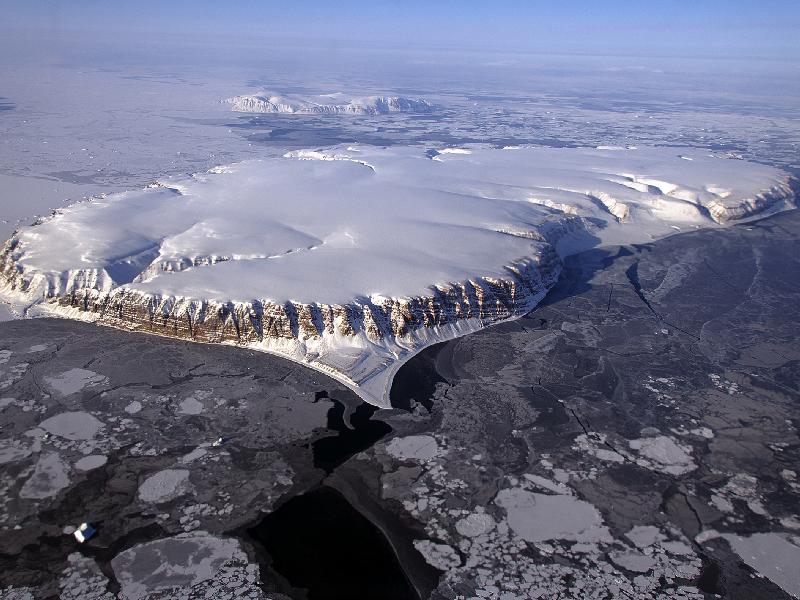
 IceBridge Survey Flight Over Saunders Island and Wolstenholme Fjord This image of Saunders Island and Wolstenholme Fjord with Kap Atholl in the background was taken during an Operation IceBridge survey flight in April, 2013. Sea ice coverage in the fjord ranges from thicker, white ice seen in the background, to thinner grease ice and leads showing open ocean water in the foreground. In March 2013, NASA's Operation IceBridge scientists began another season of research activity over Arctic ice sheets and sea ice. IceBridge, a six-year NASA mission, is the largest airborne survey of Earth's polar ice ever flown. It will yield an unprecedented three-dimensional view of Arctic and Antarctic ice sheets, ice shelves and sea ice. These flights will provide a yearly, multi-instrument look at the behavior of the rapidly changing features of the Greenland and Antarctic ice. Image Credit: NASA / Michael Studinger
No Replies
|
Forum
|
POPULAR COUNTRIES
 India
India USA
USA Australia
 Spain
Spain Italy
Italy France
 Iceland
 Brazil
 Russia
 Nigeria
 Mexico
 Iran
Iran North Korea
 South Korea
 Vietnam
 Egypt
Egypt China
China Turkey
SITE NAVIGATION
About Us
I
Media
I
Site Tour
I
FAQs
I
Why Us
I
Privacy Policy
I
Contact Us
I
Careers
I
Disclaimer
I
Add Free Business
I
Advertising Options


@Copyright 2013 My Infoline -Whole World At Your Fingertips
(This site in under beta version, please feel free to send your suggestion to improve this portal , and also write a email to us if you find any bugs.)
(This site in under beta version, please feel free to send your suggestion to improve this portal , and also write a email to us if you find any bugs.)